

Ever wonder if those lines on Google Maps actually show where your property ends? It’s a good question, especially if you’re a business owner trying to get found online. We all use Google Maps to get around, but when it comes to things like property lines, how accurate is it really? This article will look into how reliable Google Maps Property Lines are for local businesses trying to improve their online presence.
Key Takeaways
- Google Maps is good for a general idea, but don’t use it for legal property line stuff. For that, you need a professional surveyor.
The info on Google Maps comes from lots of places, like public records, but it might not always be super current or totally correct. - Getting your business location right on Google Maps helps people find you and can make your local search ranking better.
If Google Maps shows your business in the wrong spot, or with the wrong property lines, it could mess up your SEO and confuse customers. - Always double-check your business address and location on Google Maps, and think about using other mapping tools for more detailed property info.
Understanding Google Maps and Property Lines
What Are Property Lines?
Property lines are the legally defined boundaries of a property. They show the exact area a person owns. These lines are important for many reasons, from building fences to settling disputes with neighbors. Knowing where your property ends and another begins is key for avoiding legal problems and making sure you’re using your land correctly.
- They define the legal limits of ownership.
- They are used in construction and development.
- They help resolve boundary disputes.
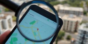
How Google Maps Displays Property Information
Google Maps offers a way to view property lines In Google maps, but it’s not always obvious how to find them. While Google Maps doesn’t have a specific “property line” layer you can just turn on, the data is often integrated into the map. Sometimes, when you zoom in closely on an area, Google Maps will display property lines as faint gray lines. Keep in mind that this feature isn’t available everywhere, and the accuracy can vary. There are also ways to create a property boundary in Google Maps, but these are for personal use and don’t hold legal weight.
It’s important to remember that the property lines on Google Maps are for general reference only. They should not be used as a substitute for a professional survey if you need precise boundary information.
Some third-party apps and websites provide more detailed property boundary information than Google Maps alone. These services pull data from public records and other sources to display property lines overlaid on satellite imagery. Some popular third-party apps include:
- OnX: Initially designed for hunters, OnX provides detailed property information, including landowner names and boundaries.
- LandGlide: LandGlide is a mobile app that allows users to access property data, including property lines, ownership information, and parcel boundaries.
- GIS Data: GIS data is generally the most accurate method of displaying property lines digitally, as it is typically sourced directly from land survey records. This data may include additional details like zoning information, easements, and property ownership records.
Accuracy of Google Maps Property Lines

Sources of Google Maps Data
Google Maps pulls data from a lot of different places, which is why it’s usually pretty good, but not always perfect. They use public records, satellite imagery, and even user contributions to piece together the map. This means the accuracy can vary quite a bit depending on where you are. For example, densely populated urban areas tend to have more accurate data than rural areas because there are more sources to pull from. GIS data, sourced directly from land survey records, is generally the most accurate method of displaying property lines digitally. This data may include additional details like zoning information, easements, and property ownership records.
Limitations and Discrepancies
Even though Google Maps is helpful, it’s important to know its limits. Property lines shown on Google Maps are approximations and shouldn’t be used for legal purposes. There can be discrepancies due to several reasons:
- Data Age: Public records aren’t always up-to-date. If a property line was recently changed, it might not be reflected on Google Maps yet.
- Interpretation: Satellite imagery can be tricky to interpret, especially when trees or buildings obscure the actual property lines.
- Human Error: Mistakes happen! Data entry errors can lead to inaccuracies.
It’s always a good idea to double-check property lines with official sources if you need precise information. Relying solely on Google Maps could lead to misunderstandings or even legal issues down the road.
Implications for Local SEO
Why does all this matter for local SEO? Well, if your business is near a property line, or shares a complex with other companies, having accurate property lines on Google Maps can help distinguish your business from nearby competitors. This clarity can reduce confusion, especially for businesses with multiple units or branches in the same vicinity. Ensuring that your property lines are visible makes your business stand out on the map, increasing your chances of attracting local customers. If the property lines are wrong, it could affect how customers find you, especially if they’re using maps to navigate to your location. This is why it’s important to verify your business location.
Implications for Local SEO
Why Accurate Property Lines Matter for Businesses
For local businesses, especially those relying on foot traffic or deliveries, accurate property lines on Google Maps are more important than you might think. They help define your service area and can influence how Google understands your business’s location. Think about it: if Google thinks your business is across the street or even next door, it could impact who sees your business in local search results. This is especially true for businesses in shared buildings or those with complex property layouts.
- Correctly defining your business’s location.
- Improving the accuracy of your local SEO.
- Helping customers find you more easily.
Inaccurate property lines can lead to confusion for customers and search engines alike. It’s like having the wrong address – people might end up at the wrong place, and Google might not show your business to the right customers.
Potential SEO Risks of Inaccurate Data
Inaccurate property line data can create a ripple effect of problems for your Google Maps SEO. If Google’s data is off, it can negatively impact your rankings in local search results. This is because Google uses location data to determine which businesses to show for location-based searches. If your business is incorrectly placed, you might miss out on valuable leads and customers.
Here’s how inaccurate data can hurt you:
- Reduced visibility in local search results.
- Lower click-through rates from potential customers.
- Damage to your business’s reputation due to customer confusion.
Best Practices for Local Businesses
Verifying Your Business Location
It’s super important to double-check that your business location is correct everywhere online. This means going beyond just trusting what you see on Google Maps. Start by confirming your physical address with official records.
Here’s a quick checklist:
- Cross-reference your address with your local county’s property appraiser website.
- Compare the address listed on your business license with what’s on Google Maps.
- Use a GPS device to pinpoint your exact coordinates and see if they match the map.
Inaccurate location data can lead customers to the wrong place, hurting your reputation and costing you business. Always prioritize accuracy and consistency across all platforms.
Leveraging Other Mapping Tools and Data
While Google Maps is popular, it’s not the only game in town. Using other mapping tools and data sources can give you a more complete picture and help you verify information. Think of it as a backup plan to ensure accuracy.
Consider these options:
County GIS (Geographic Information System) websites: Many counties offer online GIS portals that provide detailed property information, including parcel lines and ownership details. These are often more accurate than Google Maps.
Third-party mapping services: Services like Bing Maps or MapQuest can offer different perspectives and sometimes more accurate property line data. It’s worth comparing them.
Professional surveying services: For critical decisions, especially those involving property disputes or construction, hiring a professional surveyor is the best way to get precise boundary information. They can provide legally defensible data.
Using local keywords can also help improve your visibility in these mapping tools.
Conclusion
So, what’s the takeaway here? Google Maps can be a really handy tool for getting a general idea of property lines. It’s free, it’s easy to use, and it can definitely help your business show up better in local searches. Think of it as a good starting point for your local SEO efforts. But, and this is a big “but,” when things get serious, like for legal stuff or big decisions about your land, you really need to call in a professional land surveyor. They’re the ones who can give you the exact, official boundaries. Using Google Maps for your business profile can make it super clear where you are, which helps customers find you and can even help you stand out from other businesses nearby. It’s all about making it simple for people to get to you.
Frequently Asked Questions
What exactly are property lines?
Property lines are the invisible borders that show where one piece of land ends and another begins. They’re super important for knowing exactly what land you own or use.
How does Google Maps show property lines?
Google Maps shows property lines as thin outlines, often in gray or black, on its map view. They help you see the general shape and size of a property.
Where does Google Maps get its property line information?
Google Maps gets its information from many places, like public records, satellite images, and data from local governments. This helps them draw the lines you see.
Are the property lines on Google Maps always correct?
While Google Maps is helpful, its property lines aren’t always perfect. They’re good for a general idea, but for legal stuff, you’d need a professional surveyor.
Why do accurate property lines matter for local businesses?
For businesses, accurate property lines on Google Maps mean customers can find you easily. It also helps your business show up better in local searches, which is great for getting more visitors.
How can businesses make sure their location is correct on Google Maps?
To make sure your business location is spot-on, you should check your Google My Business profile. You can also use other mapping tools or even get a land surveyor to confirm your exact boundaries.